Tersus GNSS receivers deliver survey-grade precision and reliability across mapping, engineering, and construction workflows. From lightweight portable units to multi- constellation systems, each receiver integrates seamlessly with Tersus software and correction services for full end-to-end accuracy.
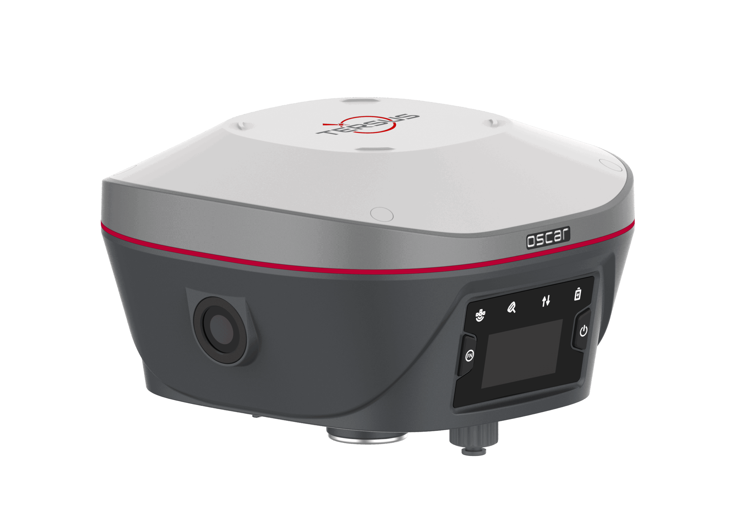
Oscar Trek GNSS Receiver
Designed for professional surveyors who demand accuracy, reliability, and efficiency in every field operation. The Oscar Trek delivers multi-constellation tracking and advanced RTK performance in a compact, durable form factor.
• Dual-frequency GNSS with GPS, GLONASS, Galileo, and BeiDou support • IMU-based tilt compensation up to 60° for faster surveying • Rapid RTK initialization (<5 seconds) with centimeter-level accuracy • Seamless connectivity via Bluetooth, Wi-Fi, and cellular modules
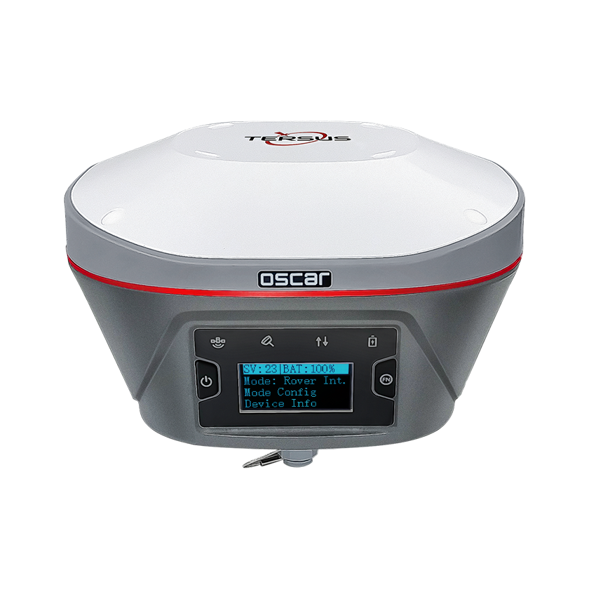
The Oscar Ultimate represents the pinnacle of Tersus GNSS performance—ideal for precision surveying and complex job sites. It combines IMU tilt technology, rapid convergence, and ultra-stable RTK corrections in one rugged receiver.
• Full-constellation RTK support with 1408 channels • Enhanced IMU fusion for improved accuracy in challenging conditions • Integrated Wi-Fi hotspot and NTRIP client for flexible correction access • IP68-rated housing with long-lasting battery operation
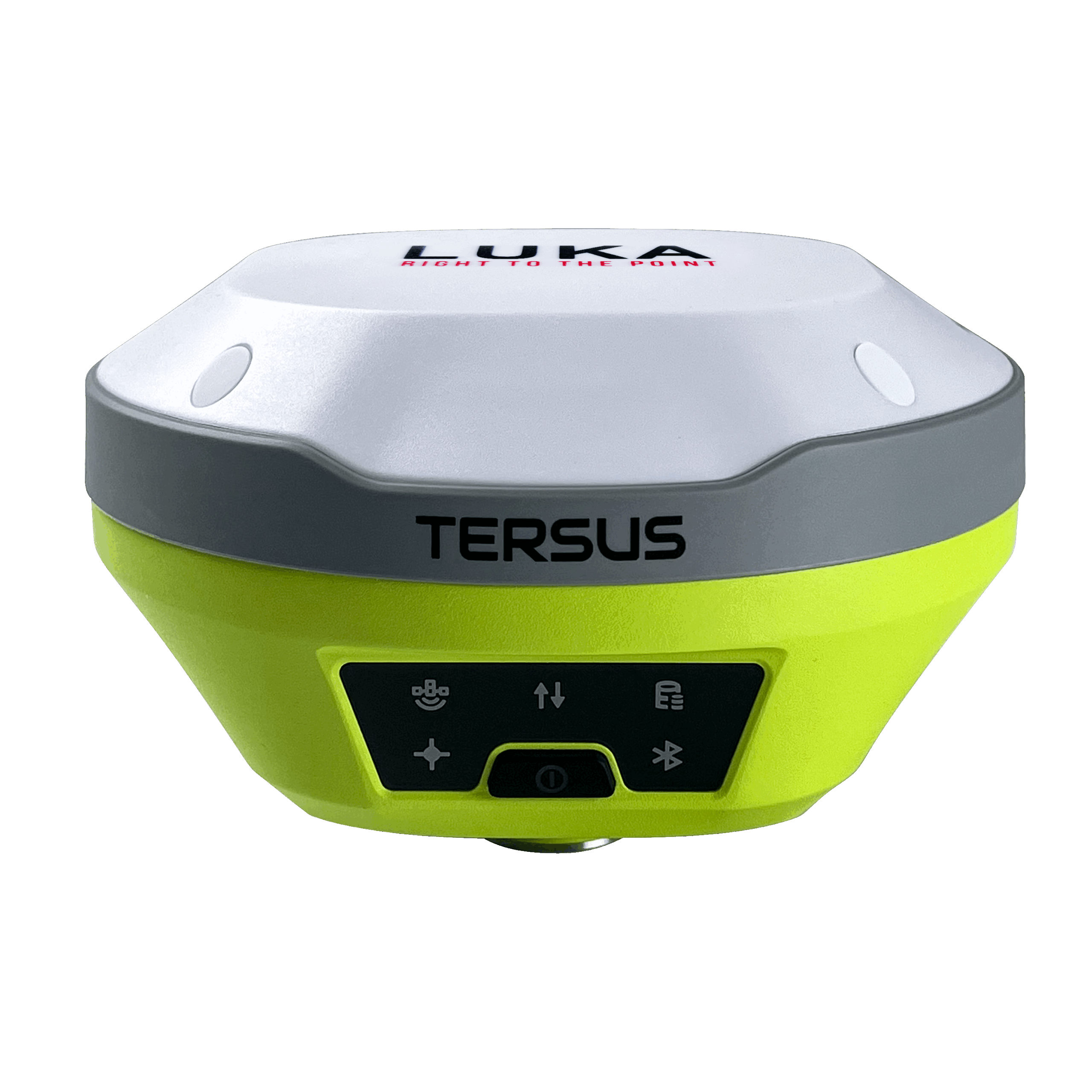
Compact, efficient, and TAP-powered, the Luka GNSS Receiver provides real-time centimeter accuracy anywhere without relying on CORS or cellular networks. Perfect for UAV, GIS, and portable survey applications.
• Powered by Tersus TAP Service for global RTK coverage • Lightweight and mountable for UAV or pole use • Bluetooth and Wi-Fi connectivity for field flexibility • Low-power design with extended runtime per charge
The Geobee GNSS Receiver balances portability and performance—ideal for mapping, GIS, and construction workflows where accuracy and ease of use matter most.
• Multi-constellation tracking for reliable positioning • Compact design with integrated antenna and data logging • Real-time RTK and post-processing (PPK) capability • Compatible with NUWA App and Geo Office software
Engineered for dependable precision, the David30 GNSS Receiver offers a rugged solution for utilities, inspection, and infrastructure surveys with proven accuracy in any environment.
• Multi-frequency GNSS receiver with centimeter-level accuracy • Strong Bluetooth range for flexible base/rover setups • Integrated battery supporting all-day operation • Dustproof and waterproof (IP67) for field durability
Data Collecting Equipment
Tersus field controllers combine rugged hardware, intuitive Android interfaces, and reliable wireless connectivity for precise GNSS data capture in any environment. Designed to pair seamlessly with Tersus receivers, they provide an ideal solution for stakeout, mapping, and field surveying applications.
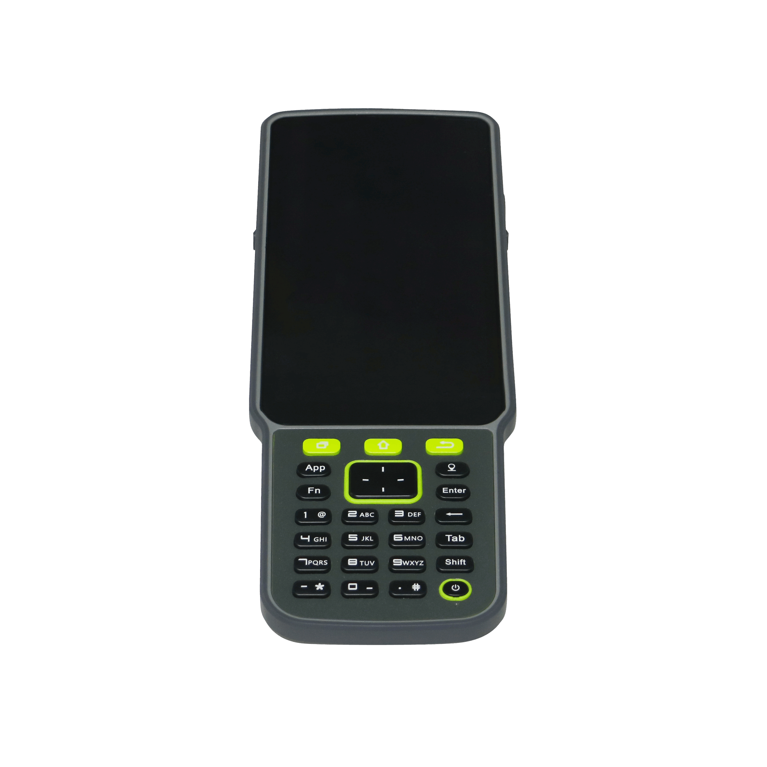
TC80 & TC40 Field Controllers
The TC80 and TC40 offer professional-grade field control in two form factors — the larger TC80 for tablet-style operation, and the compact TC40 for one-handed mobility. Both units are built to perform in demanding survey environments, balancing portability, power, and precision.
• Android-based platforms for compatibility with NUWA and Geo Office • Long-lasting batteries for full-day field operation • Sunlight-readable touchscreens for clear visibility outdoors • Rugged IP67-rated construction for dust and water resistance
Tersus software and correction services ensure complete workflow integration—from RTK corrections in the field to post-processing and reporting back in the office.
Tersus TAP Service
A global RTK correction service providing real-time centimeter-level accuracy without CORS, UHF, or cellular dependence. TAP delivers precision positioning anywhere via cloud connectivity.
• Worldwide coverage with ITRF2020 coordinate consistency • Supports all Tersus GNSS receivers and third-party devices • Simple activation through NUWA App or Geo Office • 24/7 uptime with cloud-based reliability
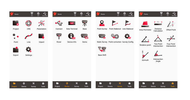
Tersus NUWA App
An intuitive Android field application for RTK surveying, stakeout, and mapping. NUWA connects seamlessly to Tersus receivers for instant field corrections and data visualization.
• Real-time map interface with project management tools • Supports Bluetooth and Wi-Fi connections to receivers • Import/export data in common GIS formats (CSV, DXF, KML) • Offline map support for remote environments
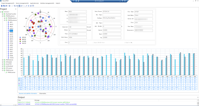
Tersus Geo Office
A powerful desktop suite for GNSS data processing, device management, and configuration. Geo Office bridges field and office workflows for efficient, accurate deliverables.
• Comprehensive PPK and RTK post-processing tools • Automatic data import from Tersus devices • Export compatible with CAD and GIS software • User-friendly interface for streamlined reporting
Integrated Mapping & Sonar Solutions
Tersus delivers advanced mapping and sonar solutions that extend GNSS precision into 3D and hydrographic environments. From terrestrial SLAM scanning to shallow-water bathymetry, these systems integrate seamlessly with the Tersus ecosystem for end-to-end spatial accuracy.
MVP S2 SLAM LiDAR System
A compact and versatile SLAM LiDAR system for 3D mapping and infrastructure inspection. Ideal for handheld, backpack, or vehicle-mounted workflows.
• High-density point clouds with integrated IMU and GNSS fusion • Operates in GPS-denied environments using SLAM technology • Lightweight modular design for flexible deployment • Compatible with Tersus Geo Office and post-processing workflows
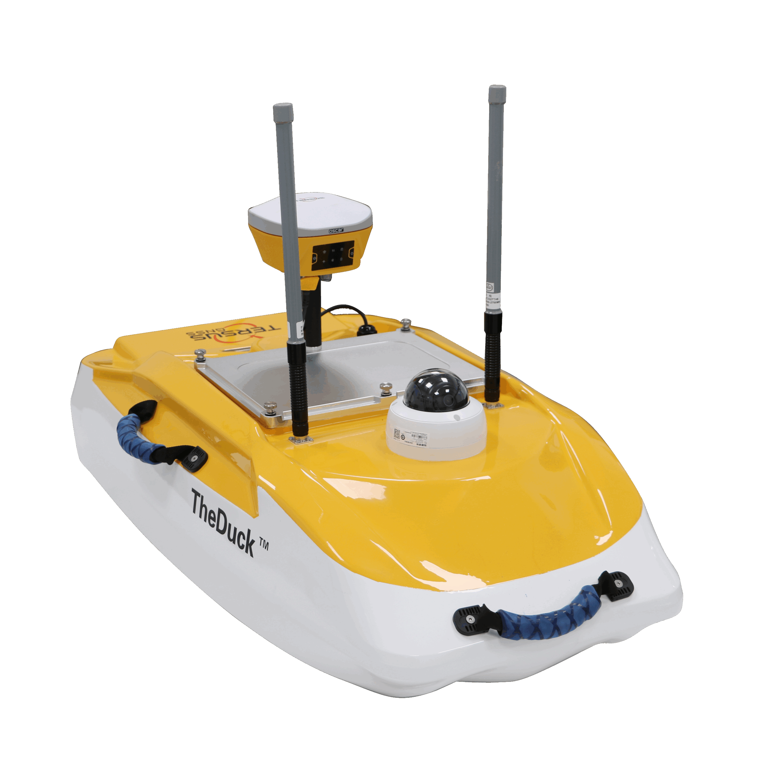
Tersus DUCK Sonar
A compact single-beam echosounder designed for shallow-water bathymetric mapping and hydrographic surveys. Integrates seamlessly with Tersus GNSS receivers and software for real-time georeferenced depth data.
• Depth range up to 30 m with ±1 cm + 0.1% accuracy • Bluetooth and RS-232 connectivity to Tersus receivers • Ideal for USV, kayak, and shore-based deployments • Integrates with TAP and Geo Office for precise georeferencing